|
This document contains the census statistics for Kamloops, British Columbia and its surrounding region from 1870-1971. Census statistics mostly consist of population socio-economic statistics, but also include some business/industry, agricultural, institutional and housing statistics. These numbers have been collected from the Canadian censuses. The TRU Library has a complete collection of the Canadian censuses to 1991 on microfilm (microfilm cabinets in reference area), a partial collection in paper from 1871-2001 and an electronic collection (CD-ROM & online) from 1986-2001.
|
| |
|
| History of the Census |
|
| The Canadian census has a long history. The first census was conducted in New France in 1666 by Jean Talon and many more were conducted in New France and British North America until Confederation in 1871. From that time forward, the legal purpose of the census was to determine representation in government and redistribute the seats every 10 years as population change warranted it. Census information is used for other important purposes such as the assignment of provincial transfer payments and the study of housing, health, education, and transportation needs. |
 |
|
The most important purpose of the Canadian census, however, is to provide by enumeration a snapshot of Canadian society. This data, when analyzed over time against the background of history and environment, provides an understanding of the evolution of Canadians and Canada.
|
| |
| |
|
| De jure vs. De facto methodoloy |
|
| To properly interpret the Canadian census it is important to know that it is conducted using the de jure rather than the de facto principle. The de facto method is easier because it just assigns an individual to the locality where they are found on the census date. Under the de jure method an individual is enumerated as belonging to the locality that they normally reside in, even if on the census date they are elsewhere – visiting, non-resident students, patients in a hospital, armed forces, etc. The de jure method requires a lot more tracking of individuals; however, since the main reason for the census is for parliamentary representation, the use of the de jure method is necessary in Canada given its great geographical size and relatively small spread-out population. |
| |
| |
|
| Availability of information and thresholds |
|
One problem with using the census to find information is the size threshold that is applied to specific data variables. What this means is that the availability of statistical information is often dependent on the population of the place. Certain statistical variables will not be available for the City of Kamloops when it falls below the specific population threshold for that variable. The statistics in this document are given at the most detailed geographic level that is available for Kamloops. The earlier censuses did not record data for the village of Kamloops; Kamloops data was incorporated into the broader geographic categories of district or subdistrict. From 1870-1901 census statistics will be provided for the district or subdistrict containing Kamloops – whichever is more detailed. After 1901, census statistics will be provided for both the city and the region that contains it.
|
| |
|
Some of the other problems inherent to the census are: census geographic boundaries are not constant due to population change and changing political boundaries; the questions being asked frequently change (old ones dropped, new ones added) and evolve (ex/ marital status, religion, origin, etc.) to more accurately reflect the characteristics of the population. This makes it difficult to compare and analyze the population statistics for a place over time. The changes in census boundaries have been particularly problematic in the case of Kamloops which has not only grown by natural population increase but also by amalgamation with its surrounding communities.
It is hoped that this subset of Kamloops data extracted from the Canadian censuses and collected in this document will aid in the study of the evolution of the city and its surrounding region. |
| |
|
| Census data up to 1870 |
|
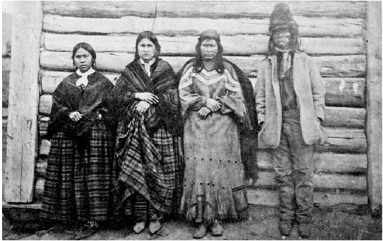
| The Shuswap people were the first residents in the Kamloops area. Although they were mostly nomadic, they did winter in pit-house villages at various locations in this area. The first fur traders arrived in 1811 and in 1812 the Pacific Fur Company established Fort Kamloops on the south side of the river junction, the first white settlement in southern British Columbia. They were followed shortly after by the North West Company who set up Fort Thompson on the northeast side of the junction of the two rivers. In 1813 the Pacific Fur Company left the area. In 1821 the Hudson's Bay Company took control of Fort Thompson after the union with the North West |
 |
| Company. In 1842 a new post was built on the northwest side of the river junction. Up until the 1850's fur trading remained the major activity in the area. The discovery of gold in the 1850's in the interior of British Columbia brought an influx of gold seekers some of whom settled in the area to farm and ranch. The fort at Kamloops became a regional depot. In 1863 a small village consisting of a fort and a store was built on the south shore of the Thompson River. The first sawmill in the area was built in 1868. In later years the lumber industry was to become very important to the area. |
| |
|
| The 1870/71 Census of Canada contains the first mention of Kamloops in a census document. This occurs in a table (1871, V. 4, p. lxxviii) containing information submitted by the officers of the Hudson's Bay Company. In 1856 the Hudson's Bay Company attempted to determine the population of the trading country covered by their forts. Their estimate of the population of the |
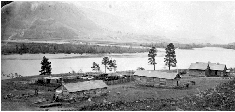 |
| British Columbia Territorial Division was 33,586 – 23,000 aboriginals and 10,586 other. All the results of their survey were published in a memorandum presented to the Special Committee of the House of Commons and this report has been reproduced in Volume 4 of the 1870/71 Census. The portion of the table specifying Kamloops has been reproduced below. |
| |
|
| Establishments of the Hudson's Bay Company in 1856, and the Number of Indians frequenting them: |
| Post |
Locality |
Department |
District |
Number of Indians Frequenting it |
| Kamloops |
Indian Territory |
Western |
Thompson's River |
2000 |
| Fort Hope |
Indian Territory |
Western |
Thompson's River |
|
| |
|
| The 1870/71 Census was the first census done after Confederation and the formation of the Dominion of Canada; it enumerated the four provinces of Quebec, Ontario, New Brunswick and Nova Scotia. It did not include British Columbia because the Census Act that authorized its taking was assented to on May 12, 1870 and this occurred before British Columbia joined Canada as a province in 1871; however, Volume 4 of the 1870/71 Canada Census contains the summaries of all the censuses done in New France and British North America from 1665 to 1871, including the 1870 Census of British Columbia. This was the only census done in the colony of British Columbia prior to the colony joining Canada. In fact, the two colonies of Vancouver Island (established in 1849) and British Columbia (established in 1858) were only joined into one in 1866. |
| |
|
| The 1870 Census of British Columbia divided the colony into 18 districts and recorded a total population of 10,580 (1871, V. 4, p. 376).The aboriginal population of the colony at that time was estimated to be between 25,000 and 50,000 (1871, V. 4, p. 377).This census did not record population figures for areas smaller than a district and therefore there are no specific numbers available for the Kamloops area. The Kamloops area was included in the Yale district and the 1870 Census of British Columbia did record statistics (population, gender, race, employment, births, marriages) for the combined districts of Hope, Yale and Lytton. |
 |
| In 1870 the total non-aboriginal population of the Hope, Yale and Lytton districts was 1,067 (1871, V. 4, p. 376). |
| |
|
|
One of the reasons that British Columbia had joined Confederation was the promise of a transcontinental railroad. Surveying started after 1871 – this provided work for the local settlers and a market for their produce and meat.
|
| |
|
| Census data 1880-1881 |
|
| The 1880-1881 Census of Canada included British Columbia, Manitoba and Prince Edward Island in addition to the 4 provinces that had been enumerated in the 1870-71 Census. The country was divided into 192 census districts and 2,139 census subdistricts. Census districts usually corresponded to electoral districts and the census subdistricts to parochial, civil or political subdivisions. |
| |
|
| In the 1880-81 Census, British Columbia was divided into 5 districts and 26 subdistricts. By this time the total population of the province had increased to 49,459. District 189 Yale ((124,276 sq. km) had a total population of 9200 which had increased from 1316 in 1871 – the 1871 population was adjusted to reflect the new 1881 census boundaries. District 189 Yale was subdivided into the following subdistricts: |
| Subdistrict |
|
Population |
| Subdistrict A |
Yale and Hope |
2,296 |
| Subdistrict B |
Lytton, Cache Creek and c |
4,725 |
| Subdistrict C |
Nicola, O'Kanagan |
1,199 |
| Subdistrict D |
Osoyoos |
117 |
| Subdistrict E |
Kootenai |
86 |
Source: 1881 Census of Canada, Volume 1, Table 1, p. 94 |
| |
|
| According to the index at the end of Volume 1 of the 1880-81 Census, Kamloops was contained in District 189 Yale, Subdistrict B Lytton, Cache Creek & c. (insert map showing B.C. divisions in 1881) The 1881 Census index map shows that Subdistrict B included the area along the Thompson River from Lytton to Shuswap Lake and Kamloops would have been located within the B3 area. Subdistricts were sometimes further divided into two or more smaller areas that coincided with the area that one enumerator would cover. This was done in subdistricts that had a large territorial extent, a comparatively higher population density, and presented travel difficulties. Unfortunately, in the 1880-81 Census, statistics for areas smaller than the subdistrict level are only available for cities and towns with a population greater than 5,000. Therefore, the statistics for the Kamloops area would be contained in the broader statistics (population, area, dwellings, families, gender, marital status, religion, origin, birth places, occupiers of land, lands occupied) of Subdistrict B Lytton, Cache Creek & c. However, it is possible to determine the population of the Kamloops native community from the 1881 Census Schedule 1 Nominal Return of the Living, (HA 741.5 .B74 1881 in MIC) because native villages were recorded as sublocations. This method gives an estimate of 280 for the population of the Kamloops native community and therefore the total population for the Kamloops area would have been higher than this number. |
| |
|
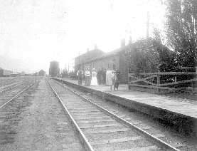
| In July 1885 the railroad track reached Kamloops and in November 1885 the first train from the east arrived. The Canadian Pacific Railway was completed in 1886. This brought workers and the village grew to include hotels, stores, schools, churches, and a hospital. In 1884 the Inland Sentinel produced the first newspaper. |
 |
| |
|
| |
|
| Census data 1891 |
|
| The 1891 Census divided British Columbia into 5 districts and 49 subdistricts. The population of British Columbia had increased to 98,173 and the population of the Yale District was 13,661. In this census there is a Subdistrict E Kamloops in Yale District 5 – its population is 1,517 - 928 males and 589 females (1891, V. 1, Table 2, p. 8). Although no reference map for 1891 is available, Subdistrict E probably covered the region from Kamloops Lake to Shuswap Lake – this would roughly correspond to the 1881 B3 area. This would follow the general pattern that has been observed over the censuses since 1871 of a gradual reduction in the size of the subdistricts due to the corresponding rise in population. |
| |
|
| In 1893 Kamloops was incorporated as a city (1931, V. 1, p. 193-194). According to the City of Kamloops annual reports the population of the city at incorporation was approximately 500. This statistic probably only included the people living within the actual city limits of Kamloops and not the rural area around it. It would also not have included the native reserve, or the people living on the north side of the Thompson River as the city of Kamloops was located on the south shore of the river. The first bridge to the North Kamloops area was built in 1901. |
| |
|
| Census data 1901 |
|
| In the 1901 Census the Yale and Cariboo districts were combined into one district with 12 subdistricts. Kamloops was located within Subdistrict K Yale, North. This is the first census which actually recorded a specific population figure for the city of Kamloops: 1,594 people (1901, V. 3, Table XXI, p. 331); probably because this was the first census taken after the incorporation of Kamloops. This census also collected some business statistics for the city. |
| |
|
|
In 1905 the census office became a permanent part of the government. Also in that year, Alberta and Saskatchewan became provinces. In 1906, the three prairie provinces began to take a separate census of agriculture every five years to monitor the growth of the West. This was necessary due to the rapid expansion in Western Canada. In fact, the taking of a separate quinquennial (mid-decade) census of agriculture had begun in Manitoba in 1896.
|
| |
|
| Census data 1911 |
|
| In the 1911 Census the Yale & Cariboo District was divided into 16 subdistricts which included Kamloops and Kamloops c. Kamloops was the rural region around the city and Kamloops c was the actual city. To put it into perspective, the size of the Kamloops subdistrict was 10,384.33 sq. mi. and the size of Kamloops c subdistrict was 1.19 sq. mi. The population of the city of Kamloops was 3,772. |
| |
|
|
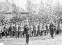
Between the 1911 and 1921 censuses some of the events influencing Kamloops included World War I from 1914-1918 and the completion of the Canadian Northern Railway in 1915. The completion of the latter added some more railroad workers to the local population. In 1912 responsibility for the census shifted from the Ministry of Agriculture to the Ministry of Trade and Commerce. Six years later in 1918 the Dominion Bureau of Statistics was created.
|
 |
| |
|
| Census data 1921 |
|
|
In the 1921 Census the Yale & Cariboo District was separated into two: the Yale District and the Cariboo District. The Kamloops c and Kamloops subdistricts now fell into the Cariboo District. The other cities in the Cariboo District included Prince George, Merritt and Salmon Arm. In this particular census all the Indian reserves in a district were entered as one subdistrict. The population of the city of Kamloops was 4,501.
|
| |
|
| Census data 1931 |
|
|
1931 was the Depression census and a new question on unemployment was added. British Columbia's census boundaries had again changed and the terms census district and subdistrict were replaced by the modern census division and subdivision. Census divisions were established for British Columbia (1931) and the other Western provinces (1921) because they did not have the political units of counties that were present in Eastern Canada. The old census geographic system for British Columbia had been based on electoral districts, but these were subject to change after each census. To make it possible to compare data from one census to another for areas smaller than a province, this new system of more fixed boundaries was adopted. The City of Kamloops was now in Census Division 6, Subdivision C Nicola along with Merritt; the other city in this division was Salmon Arm which was included in the Shuswap Subdivision. Within a subdivision there were 3 categories: municipalities (cities, villages, towns, etc.), Indian reserves and unorganized parts (rural areas); these categories combined to form the entire subdivision. This was a change from previous censuses where the subdistricts (municipalities, Indian reserves, and unorganized areas) were all separate and only combined to form the district. In addition to Nicola, Census Division 6 included the North Thompson, Shuswap, South Chilcotin, Lillooet East, and Bridge Lillooet subdivisions. The city of Kamloops had a population of 6,167 and was ranked 112th in Canada by population size. The unemployment rate was 37% in Kamloops. This census also included an institutional survey and did record information for Royal Inland Hospital.
|
| |
|
| Census data 1941 |
|
| 1941 was the war census. The Depression had taken its toll on Canadians socially and economically; the number of immigrants and marriages had fallen. Development and growth had slowed in the city of Kamloops during the Depression and the beginning of World War II. In fact, the population in the city of Kamloops dropped to 5,959 by 1941 – Kamloops was ranked 129th in Canada by population size. The average house price in the city was $2821 and the average annual earnings for wage-earner families was $1033. Kamloops city was still in Census Division 6 Subdivision C Nicola. A map of the B.C. census divisions and subdivisions can be found on p. 974 of Volume 1 of the 1941 Census of Canada. This census recorded substantially more information (area, population, origin, religion, dwellings, tenure, households, families, earnings, wage earners, employment status, occupations, retail trade, wholesale trade and retail services) for Kamloops city. |
| |
|
| Census data 1951 |
|
| The 1951 Census included Newfoundland for the first time following its union with Canada in 1949. It also recorded war service in the two world wars. The geographic entity of census tract for larger cities made its first appearance. A census tract usually corresponded to a neighbourhood (population 2000-3000). Prior to 1941 the intention had been to set up social areas (census tracts) within the larger cities for the publication of census statistics; however due to the war it was not possible to proceed with this |
 |
|
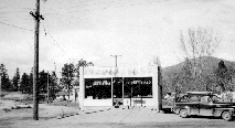
type of geographic division until 1951. The 1951 Census was the first time that unincorporated places appeared and both their 1941 and 1951 population estimates were recorded. For the Kamloops area there was now population information for Barnhartvale, Brocklehurst, Powers Addition, Halston, Knutsford, Mission Flats, Victoria West and Westsyde. The village of North Kamloops also appeared for the first time after its incorporation in 1946. Kamloops was still in Census Division 6 Subdivision C Nicola. The population of Kamloops in 1951 was 8,099 – a 30% increase from 1941. Kamloops was ranked 134th in Canada by population size.
|
| |
|
| Census data 1956 |
|
|
The 1956 Census was the first national quinquennial (mid-decade) census. Rapid economic and population growth had made it necessary to increase the frequency of census taking. The Census of Agriculture was extended to the whole country and was conducted concurrently with the Census of Population. The quinquennial census was not as detailed as the decennial census in order to reduce costs. By 1956 the population of Kamloops and North Kamloops had increased to 9,096 and 4,398 respectively. The dramatic population growth in the village of North Kamloops is not due to natural growth or in-migration; rather the growth is the result of municipal boundary changes to the village of North Kamloops in 1956; in fact, the municipal boundaries for Kamloops city were also changed in 1953.
|
| |
|
| Census data 1961 |
|
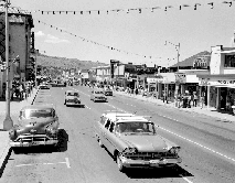
| The 1961 Census introduced a new question on the level of education of household members. A lot of the census results were cross-tabulated with gender. The municipal boundaries of both Kamloops (1959) and North Kamloops (1960) were again modified prior to the 1961 Census. This census also brought a tremendous increase in the data available for Kamloops because the city had surpassed the important 10,000 population threshold figure. Kamloops had a population of 10,076 and was ranked 172nd in the country by population size. This census also recorded the population of unincorporated places with 50 or more persons for 1956 and 1961. |
 |
| The one important area that was missed in the unincorporated list was Brocklehurst. It definitely shows on the maps of the time as an unincorporated area. One possible explanation is contained in the following statement “When an unincorporated place straddles the boundary between two municipalities, this place has been allocated to the municipality where the largest part of its population is located.” Using this explanation it is possible that the population of Brocklehurst may have been included with North Kamloops. |
| |
|
|
The modern Trans Canada Highway was opened in 1962. Kamloops Pulp and Paper was established in 1964.
|
| |
|
| Census data 1966 |
|
| The 1966 Census was the second quinquennial census of population done. As in 1951, the census was not as detailed as the decennial census to reduce costs. Kamloops and North Kamloops were still in Census Division 6 Subdivision C Nicola. In 1966 the population of Kamloops was 10,759 and the population of North Kamloops was 11,319. This dramatic growth in the population of North Kamloops was definitely not all due to natural growth or in-migration; North Kamloops annexed some territory in 1966 from the unorganized part of Subdivision C to increase in size from 1.75 sq. mi. to 5.89 sq. mi. Also, North Kamloops was classified as a town in 1966 rather than a village. Starting with this census, Subdivision C was treated separately from the cities, towns and villages contained within its boundaries and therefore will no longer be included in the tables as it can not be properly compared to previous censuses. This census also recorded the population for unincorporated places of 50 persons and over. |
| |
|
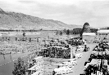
| In 1966 North Kamloops Town annexed parts of Subdivision B and in 1967 North Kamloops amalgamated with Kamloops to form one city. By the end of 1968, all of the province had been divided into 28 duly incorporated Regional Districts. These Regional Districts had been created by an amendment to the Municipal Act in 1965. These new geographic entities were very similar to counties and included both incorporated and unincorporated areas. Kamloops was in the Thompson-Nicola Regional District which had been incorporated on November 24, 1967. Logan Lake village was incorporated in 1970 (from Subdivision B). Valleyview which had been |
 |
|
incorporated as a village in 1969 became a town in 1971 (from Subdivision E). Also in 1971, Dufferin became incorporated as a district municipality. Kamloops city annexed some territory from Subdivision B in January 1971.
|
| |
|
| Census data 1971 |
|
| The geographic divisions in British Columbia were redone for the 1971 Census. The 10 census divisions which had been established in 1931 were now replaced by 28 Regional Districts created by the provincial government. In 1971 Kamloops became a census agglomeration. A census agglomeration (CA) is an area that covers the urbanized core, the surrounding fringe area (urban and rural parts) and the Indian Reserves contained in the CA. The Kamloops CA included Kamloops city, Brocklehurst, Westsyde, Valleyview Town, Dufferin District Municipality, Skeechestn Indian Reserve and a large rural part of Subdivision B. It did not include the Kamloops Indian Reserve, Dallas, Barnhartvale, Knutsford, Rayleigh or Heffley Creek. Provincial census tracts – smaller geographic areas - appeared for the first time; however these were more useful for the rural rather than the urban areas. |

